LF98
LF98
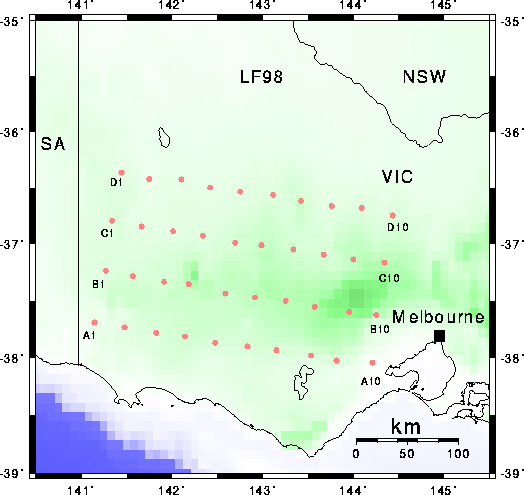
This map shows the locations of short-period vertical-component seismic recording stations that were installed for the LF98 seismic experiment. The first station was installed on May 4, 1998, and station number 40 went in on May 15, 1998. Nominal station separation was 30 km along the array (approx. E-W) and 50 km across the array. The array was maintained for approximately 4 months, generating over 1 Gbyte of data each week during that period. The aim of this project was to record first arrivals from distant earthquakes, particularly those from the Tonga-Fiji and Indonesia regions. The dataset has been used to construct images of crustal and lithospheric structure to depths of approximately 300 km beneath the array.
Equipment for this seismic array was provided to a consortium of Australian Universities by the Australian Research Council. Recorders were built at the ANU. Support for the LF98 project was provided by an ARC Large grant to Greg Houseman and Stewart Greenhalgh. This image is constructed using the GMT package of Wessel and Smith; locations are overlain on the ETOPO5 topography dataset.
See the Field Photo Album.
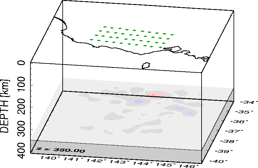
A Different Perspective
To see the seismic wavespeed maps in 3D animated perspective, follow
these links: N-S
sections, E-W
sections, horizontal
sections.
Please note that these 3-D animated gifs are large and slow to download.
Return to author profile.