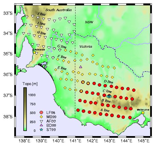
This 3-year program of field experiments was carried out from Monash and Adelaide Universities by principal investigators Greg Houseman and Stewart Greenhalgh and Research Fellow Frank Graeber, during 1998, 1999 and 2000. The object was to construct a 3D map of the lithosphere across the south-western part of the Paleozoic Lachlan and Adelaide Fold belts in the vicinity of the so-called 'Tasman Line' the boundary between Proterozoic Central Australia and the younger Paleozoic Fold belts. This project was carried out with the support of the Australian Research Council and used a portable array of 40 seismographs built at the Australian National University ANU) and operated by the Joint Universities Seismology Facility (JUSF).
The fieldwork was divided into 3 phases. Each year we covered a region of about 40,000 square kilometres by deploying the array of seismographs and recording continuously the signals received from distant earthquakes. The LF98 project in 1998 focussed on the western part of the Lachlan Foldbelt, the area from Geelong and Bendigo in the east, across to the South Australian border. The MB99 project in 1999 spanned the southern part of the Murray Basin, straddled across the Victorian - South Australian border. The AF2000 project in 2000 focussed on the Adelaid Fold belt from the coast between Adelaide and Port Pirie out to the New South Wales border. In addition we operated four broadband triaxial seismographs in western Victoria during 1999 and 2000.